This is a brief example to illustrate several features of old maps:
1 General inaccuracies and inconsistencies
2 Variations in spelling.
3 Position variations due to village migration. In
this case, Pembury, south of Tonbridge.
This
page features a gimmick called 'mouse-over' by which the image changes
when the mouse is placed over the image - no clicking involved.
It is
used here to highlight the point of interest.
The maps shown below are not to the same scale.
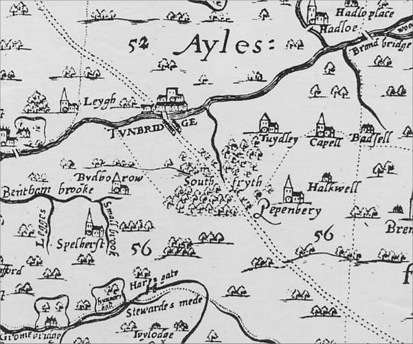
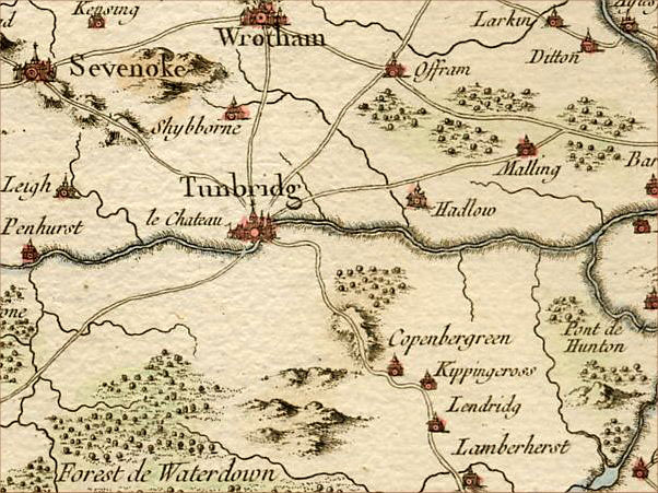
The map above shows
Pembury before 1575 to the east of the main London to Hastings road.
This is the original settlement at low ground, close to streams and
ponds.
The Hastings Road runs across a ridge of high ground - more durable in
wet weather.
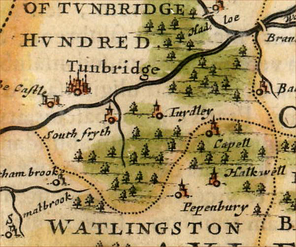
A map of the 1640s from a
survey of the 1580s. London to Hastings road
not shown.
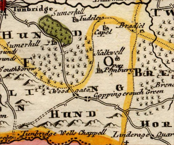
A map of 1699
showing Pembury east of the Hastings Road.
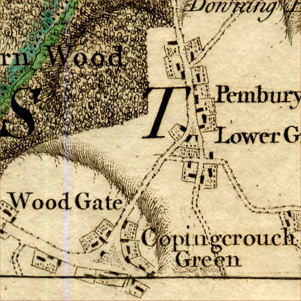
The small settlement 'Copping Crouch Green' is shown on the Hastings
Road.
This part of the Hastings Road was attracting more traffic to the
popular 'Tunbridge Wells'.
It was also seeing greater traffic from London to Rye (for commerce)
and from
Hastings to Tonbridge and beyond (for fish deliveries).
Woodgate is now the
major junction for the Maidstone - Tunbridge Wells road
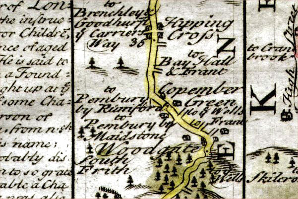
A road map of 1720 showing
the road through Pembury.
( see mouse-over change for inclusive notes )

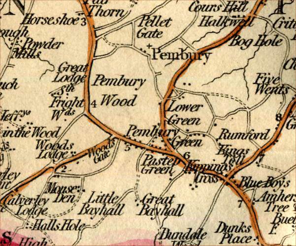
A map of 1753 showing both
settlements with Pembury to the east
and Pippenbury Green on the Hastings Road.
Note the increased settlement along the Hastings Road.
This map also shows a 'Halfway House' north and south of Pembury.
These were refreshment inns for the traveler and their inclusion
indicates their growing importance.
The northern one is the 'Vauxhall Inn' and the southern is the 'Blue
Boys'.
A map of 1760
only showing 'Copenbergreen' on the Hastings Road
and no mention of Pembury.
A map of the 1780s showing
Pembury and Copingcrouch Green.
Old Pembury also having the name 'Lower Green'.
The detail is good enough to show the two settlements.
It also shows the Hastings Road running on the ridge of high ground.
A Map of the early 1800s
showing 'Pembury Green' on the Hastings Road.
The old settlement now referred to as Lower Green.
Today the road linking the two areas is 'Lower Green Road'.
Earlier references to
Halfway House now 'Horseshoe' and 'Blue Boys' inns.
Milestones shown on this
map.
A map of the 1830s with no
mention of Pembury.
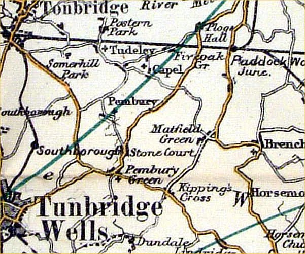
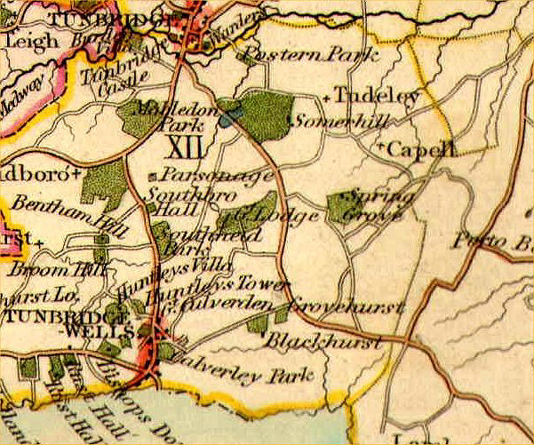
A map of the 1890s showing
Pembury and Pembury Green
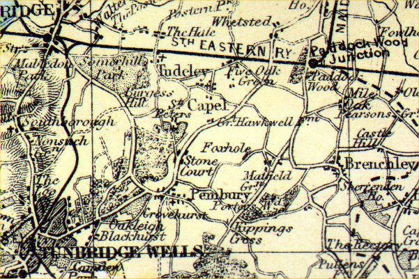
A map of the 1890s showing
Pembury firmly on the Hastings Road.
(the old settlement is indicated by the blue circle)
Note the development of the east-west road from Tunbridge Wells to
Maidstone via Pembury.
The Pembury content was prepared by Tony Nicholls.
For more Pembury related maps visit www.pembury.org.uk
- see Historical Pembury section.
|